Latest Version
3.22.0
May 07, 2025
Garmin DCI
Education
iOS
1.4 GB
0
Free
Report a Problem
More About Garmin GPS Trainer
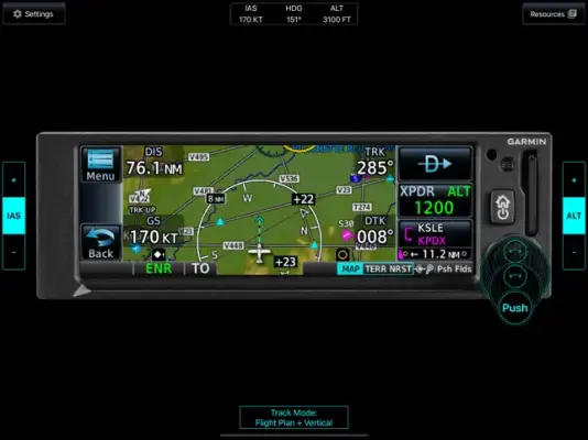
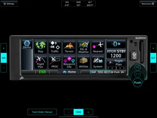
The GPS Trainer application offers a user-friendly, interactive experience designed to simulate various aspects of aviation navigation. It features a multi-touch and drag interface that allows users to engage directly with the system. This includes capabilities such as graphically editing flight plans and performing other interactive tasks, making it a useful tool for learning and practicing aviation navigation procedures in a simulated environment.
Additionally, the app incorporates Garmin SafeTaxi, a feature that provides detailed airport information displayed on a moving map. This integration helps users familiarize themselves with airport layouts, taxi procedures, and relevant airport data, enhancing their understanding of airport operations and navigation within a controlled, educational setting.
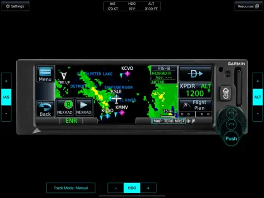
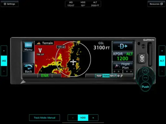
The application includes high-resolution terrain maps and extensive aviation databases covering entire world regions. It also provides high-resolution obstacle databases, which include features such as power line alerting. These detailed maps and databases are designed to give users a realistic visual experience, aiding in navigation planning and situational awareness within the simulated environment.
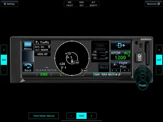
Furthermore, the GPS Trainer offers simulated data for various in-flight scenarios, including ADS-B Traffic with TargetTrend™ for relative motion perception, and FIS-B Weather data displayed with animated NEXRAD radar images. It also incorporates visual representations of airspaces, airways, and reporting points. However, it is important to note that all data is simulated, and the app does not connect to real Garmin systems; therefore, it should not be used for actual navigation purposes.
Rate the App
User Reviews


Popular Apps