Latest Version
January 27, 2025
OsmAnd
Travel & Local
Android
2
$4.99
net.osmand.srtmPlugin.paid
Report a Problem
More About Contour lines plugin — OsmAnd
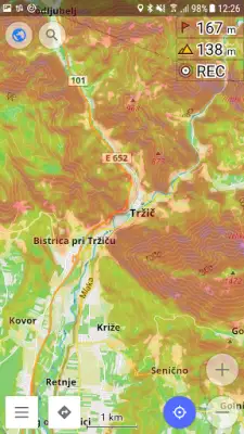
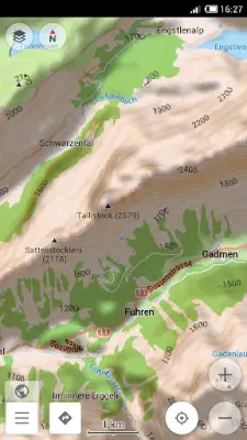
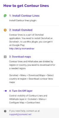
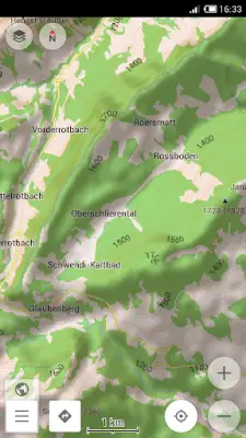
The application provides users with the ability to download contour lines and hillshade maps directly through the OsmAnd platform. To access these maps, users simply navigate to the 'Download maps' section in OsmAnd, select their desired country, and then choose either the contour lines or hillshade option. This feature enhances the user's mapping experience by adding detailed topographical information that can be beneficial for various outdoor activities, such as hiking or mountain climbing.
In order to utilize the contour lines and hillshade maps, users must first enable this specific layer of information within the app. This can be achieved by activating the appropriate plugin located within the 'Plugins' section of OsmAnd. Moreover, users need to configure the map settings by selecting the Contour Lines/Hillshade layer under the 'Configure map' option. Once these steps are followed, the user will be able to view the topographical details seamlessly integrated into their maps.
The data underpinning the contour lines and hillshade maps is derived from globally recognized satellite measurements. This information is collected from two key sources: the Shuttle Radar Topography Mission (SRTM) and the Advanced Spaceborne Thermal Emission and Reflection Radiometer (ASTER). These satellite technologies enable precise elevation readings across a vast area, specifically within latitudes ranging from 70 degrees north to 70 degrees south.
ASTER is a notable instrument operated by NASA as part of its Earth Observing System, in collaboration with Japan's Ministry of Economy, Trade and Industry and Japan Space Systems. This international partnership underlines the significance of the data provided, ensuring users have access to accurate and insightful topographical information. By incorporating this data into OsmAnd, users are equipped to better navigate and understand the terrain they are exploring.
Rate the App
User Reviews


Popular Apps