

Latest Version
5.4.2.3
June 21, 2025
PredictWind Limited
Weather
Android
0
Free
com.predictwind.mobile.android
Report a Problem
More About PredictWind - Marine Forecasts
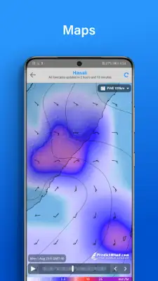
This application provides access to the world's leading forecast models for accurate wind and weather information, including globally recognized sources like ECMWF, SPIRE, UKMO, and GFS. Additionally, it offers its own proprietary PWG and PWE models, which deliver exceptional precision with a record-breaking 1-kilometer resolution, allowing users to view detailed wind patterns.
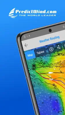
Users can access high-resolution marine weather maps that cover a wide range of data such as wind, gusts, CAPE, waves, rainfall, clouds, pressure, air temperature, sea temperature, and ocean conditions. These maps are particularly useful for marine activities like sailing and powerboating, ensuring navigational safety and planning based on detailed, real-time weather information.
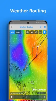
The platform also includes a suite of marine weather tools designed to enhance safety and efficiency during sea voyages. These tools utilize data on wind, waves, tides, and ocean currents to aid in route planning, helping sailors find the safest or fastest paths by factoring in environmental conditions, vessel dimensions, and tides. The Weather Routing feature calculates optimal routes from start to end points to facilitate comfortable or quick crossings.
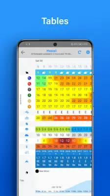
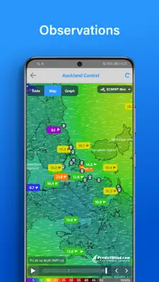
Additional features offer practical support for mariners, including daily weather briefings, high-resolution animated forecast maps, detailed tables, and comparison graphs. Real-time wind observations, webcams, local knowledge about marine sites, weather alerts tailored to user preferences, ocean data like currents and sea temperatures, GPS tracking pages, and vessel traffic monitoring with AIS data further enrich the application’s offering, making it a comprehensive tool for maritime navigation and planning.
Rate the App
User Reviews


Popular Apps