

Latest Version
9.2.0
September 01, 2025
Blue Blink One, SL
Maps & Navigation
Android
0
$94.99
com.globaldpi.agromeasuremappro
Report a Problem
More About Agro Measure Map Pro
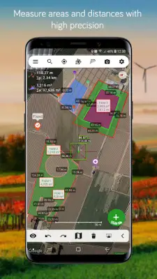
Agro Measure Map Pro is a powerful mobile application designed for precise measurements using satellite imagery. It allows users to calculate the surface areas of various landscapes such as buildings, plots, forests, and other fields without physically visiting the site. With just a simple tap on their Android device, users can obtain highly accurate measurements of distances, ranging from tiny fractions of a meter to thousands of kilometers or miles. The app also factors in the curvature of the earth, ensuring the measurements are as precise as possible.
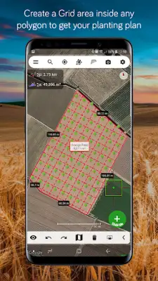
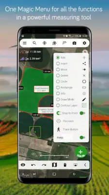
The app features a single "Magic" button that simplifies operations, making it easy to place points and draw shapes while maintaining professional-level accuracy. Users can create unlimited polygons, draw shapes like circles and rectangles, and perform complex operations such as splitting polygons, creating buffers, contour lines, and grid areas within polygons. These features are especially useful for land surveyors, agricultural planners, or anyone involved in field work, allowing them to quickly analyze terrain and other spatial data from satellite images.
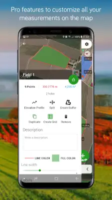
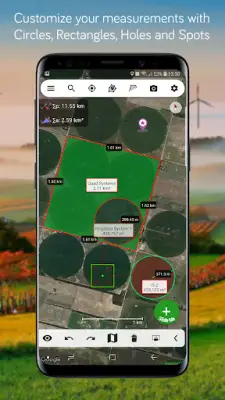
Agro Measure Map Pro offers a wide array of advanced features to enhance its usability and precision. It supports various map views including standard, satellite, hybrid, and terrain, along with 3D building displays. The app provides elevation profiles, azimuth and bearing calculations, and the ability to measure multiple areas and routes simultaneously. Users can also customize visual aspects such as perimeter line colors, transparency, and line thickness. Additionally, the app facilitates sharing exported files via different formats, including KMZ, KML, CSV, GPX, images, and PDF, making data management straightforward.
Compared to its non-pro version, Agro Measure Map Pro allows for unlimited pins and polygons, creating inner polygons as "holes," and importing/exporting a variety of file formats. It also offers a track mode for GPS-based tracking, the "snap to point" feature for precise placement, and elevation profile display along routes. These enhancements make the Pro version particularly suitable for professional and demanding users who need comprehensive tools for detailed mapping and measurement tasks, ensuring accuracy, flexibility, and ease of use in all their field measurements.
Rate the App
User Reviews


Popular Apps