Latest Version
v11.11.1075
December 02, 2024
NAVITEL
Maps & Navigation
Android
14
Free
com.navitel
Report a Problem
More About Navitel Navigator GPS & Maps
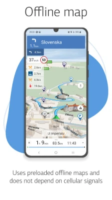
This application offers a variety of advantages for users looking for a reliable and efficient navigation tool. One of its main strengths is its modern and user-friendly interface, making it easy for anyone to use. Additionally, it offers offline maps, meaning that users do not need an internet connection to access the program and maps. This not only saves on roaming costs, but also allows for independence from the quality of communication in different regions.
The navigation maps provided by this application are highly detailed, providing users with accurate and up-to-date information. The voice search feature makes it even easier to find specific locations, while the POI (points of interest) search allows for convenient browsing of different categories. Once a route is selected, the app provides both visual and voice guidance, as well as important information about road warnings, speed cameras, and other potential hazards.
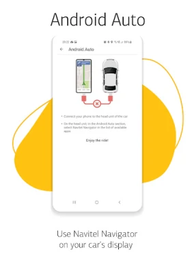
One unique feature of this app is the HUD (Head-Up Display), which allows for a safer and more convenient navigation experience by projecting important information onto the windshield of the car. The app also offers detailed navigation maps for 67 countries and territories, which can be purchased within the app.
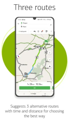
In addition to its many advantages, this app also offers a range of special features. These include fast route calculation, with the ability to instantly calculate and route any length and complexity. It also provides users with three alternative routes, along with distance and travel time information. The Navitel.Traffic feature provides real-time information on traffic jams, while Navitel.Events marks road accidents, road works, speed cameras, and other events on the map based on user input.
Other notable features include speedcam warnings, 3D mapping, 3D road interchanges, lane assist, turn-by-turn voice guidance, and a cargo graph for trucks. The app also supports multiple languages and allows for customizable user interface and map display. Users can also make purchases within the app for new map packs or renewals. For any questions or concerns, users can contact the support team via email.
ADVANTAGES
• Modern user-friendly interface
• Offline maps. To work with the program and maps, you do not need the Internet: savings in roaming and independence from the quality of communication in the regions
• Navigation maps with a high level of detail
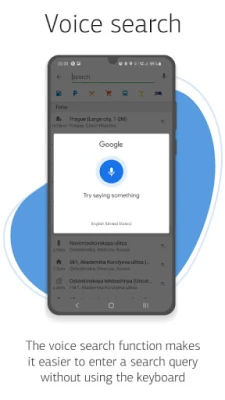
• Voice search
• Easy and convenient POI search by category
• Visual and voice guidance along the route
• Actual information about road warnings, potentially dangerous places, speed cameras, road restrictions, etc.
• HUD (Head-Up Display)
• Detailed navigation maps of 67 countries and territories of the world are available for purchase.
SPECIAL FEATURES
• Fast route calculation. Instant calculation and routing of any length and complexity.
• 3 alternative routes with distance and travel time information.
• Navitel.Traffic. Information on all traffic jams in the covered area, available in real-time.
• Navitel.Events. Road accidents, road works, speed cams, and other events marked on the map by users.
• SpeedCam warnings. Information on radars, video recording cameras, and speed bumps.
• 3D Mapping. Three-dimensional maps with texture and number of floors support.
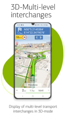
• 3D Road interchanges. Displaying multilevel road interchanges in 3D mode.
• Lane Assist. Route calculations taking multilane traffic into account and visual prompts while following the route
• Turn-by-turn voice guidance while moving along the route.
• Cargo graph: building routes considering road signs for cars from 3.5 - 20 tons, with the ability to customize the parameters of your vehicle and get a route that is relevant for a particular truck.
• Dynamic POI. Fuel prices, movies showtimes, and other useful information.
• Unlimited number of waypoints when building a route. Convenient route planning with an unlimited number of waypoints.
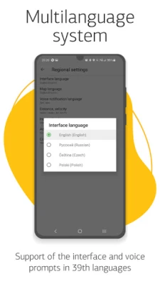
• Multilanguage. Support for interface and voice prompts in 39 languages.
• Customizable user interface. Ability to adapt the program interface and map display mode for your own needs.
• Purchases from the program menu. Purchase of new packs of maps and renewal of those already purchased from the main menu.
• Multitouch support. Quick access to map scaling and rotation functions via the multitouch input.
• Support for two navigation systems - GLONASS and GPS.
If you have any questions contact us: support@navitel.cz. We will be happy to help you.
Rate the App
User Reviews
Popular Apps


