Latest Version
1.2.2
June 11, 2025
David Gross Apps
Maps & Navigation
Android
0
Free
com.davidgrossapps.catrafficcameras
Report a Problem
More About California Traffic Cameras
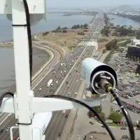
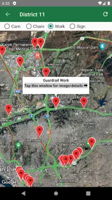
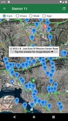
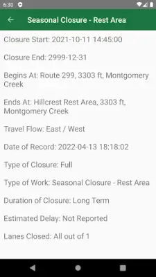
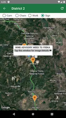
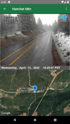
This application allows users to easily access real-time information related to California roads through an interactive interface. It provides the ability to browse Caltrans cameras, view lane and road closures, and obtain details about chain control restrictions. Additionally, users can see changeable message signs that display important road updates, making it a comprehensive tool for current traffic conditions.
All the road-related information and Caltrans camera feeds are integrated into a Google Map, which features a traffic layer to display live traffic flow and congestion data. This integration helps users quickly understand road conditions across different regions of California, making navigation and trip planning more straightforward.
The application is designed to be user-friendly by remembering the last viewed location for each Caltrans district. This means users can quickly access their preferred regions within California without needing to manually search for them each time. It enhances efficiency and provides a personalized experience for frequent users or those monitoring specific areas regularly.
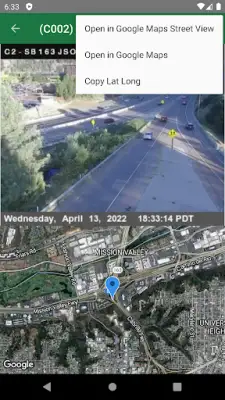
Moreover, each data point on the map includes links to Google Street View and Google Maps, allowing users to see street-level images or obtain directions directly. Users can also easily copy the latitude and longitude coordinates of any data item to their clipboard for use in other mapping or navigation applications, offering flexibility and precision in managing their travel information.
Rate the App
User Reviews


Popular Apps