
Latest Version
1.4.0
May 15, 2025
FunTreks
Maps & Navigation
Android
0
$59.99
com.neotreks.funtreks
Report a Problem
More About FunTreks 4x4 Offroad Trails
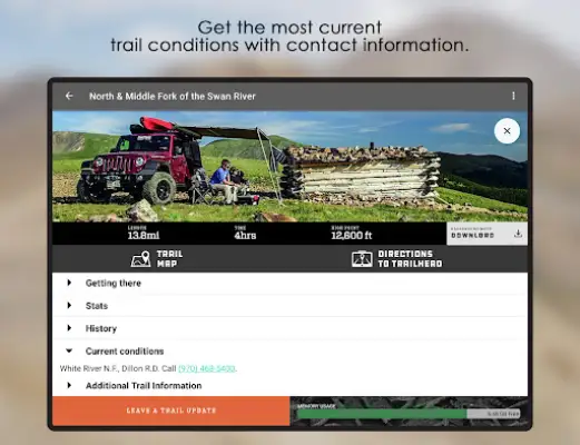
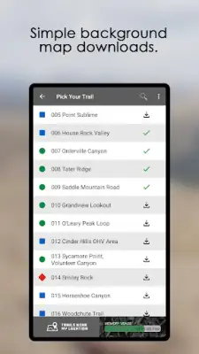
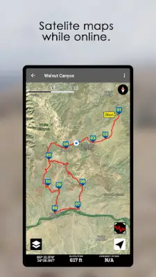
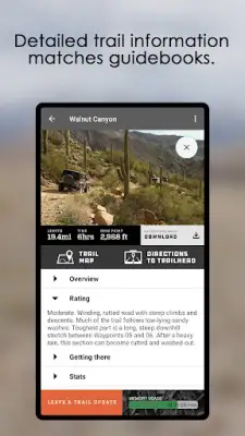
The application offers a comprehensive collection of over 600 popular offroad trails across key locations in Colorado, California, Arizona, and Moab, Utah. It provides users with detailed descriptions of each trail, including difficulty ratings, which help adventurers choose trails suited to their experience level. The app also offers essential logistical information such as directions to trailheads, trail lengths, estimated driving times, and the highest elevation points along each route. This makes planning and navigation much easier for offroad enthusiasts preparing for their trips.
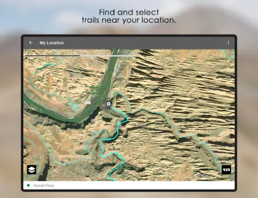
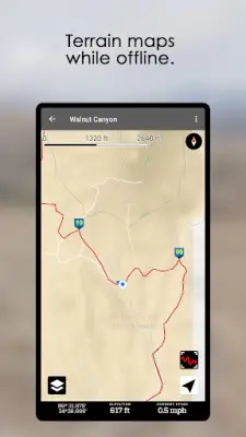
Additionally, the app supplies valuable insights into the best times of year to attempt each trail. Users can access contact information for current trail conditions, enabling real-time updates and safety precautions. The GPS track logs embedded within the app feature waypoints that correspond precisely to the trails documented in the related guidebooks, ensuring accurate navigation and trail following. This integration of comprehensive data aims to enhance the offroading experience by combining detailed guidebook information with reliable GPS navigation.
It is important to note that this application is designed to serve as a GPS companion rather than a standalone guide. It is intended to supplement the information found in FunTreks 4x4 guidebooks, which include additional resources such as custom-drawn maps, trail photos, and other detailed insights. Users are encouraged to use the app alongside these guidebooks to get the most complete understanding of each trail and improve their offroad adventures.
All the trails featured in the app have been personally driven, documented, and GPS tracked by FunTreks scouts. This careful and expert documentation ensures that users are provided with accurate, trusted trail information. The combination of expert trail oversight and detailed GPS data makes this application a valuable resource for offroad enthusiasts seeking reliable and well-documented trail guides in these popular locations.
Rate the App
User Reviews


Popular Apps