
Latest Version
22.1
February 05, 2025
Garmin
Maps & Navigation
Android
1
Free
it.navionics.singleAppMarineLakesHD
Report a Problem
More About Navionics® Boating
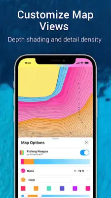
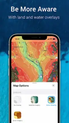
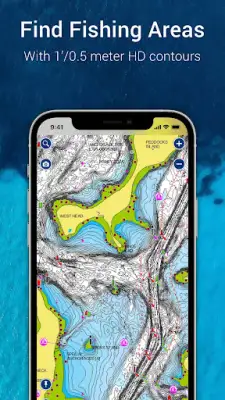
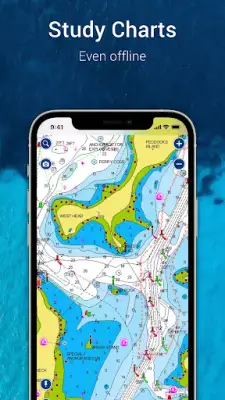
This application offers a comprehensive marine navigation package, featuring internationally acclaimed Navionics charts that can be utilized offline. Users can benefit from multiple overlays, enhancing their awareness of both surface and underwater conditions. The application includes a nautical chart that serves as a premier marine reference, providing detailed information about port plans, anchorages, safety depth contours, and the locations of navigational aids and marine services. Also included are the SonarChart HD bathymetry maps, which deliver exceptional one-foot (0.5 meter) contour detail for effective exploration of new fishing areas. Furthermore, U.S. government charts from NOAA cover various regions including the U.S., Canada, Mexico, the Caribbean, and down to Brazil.
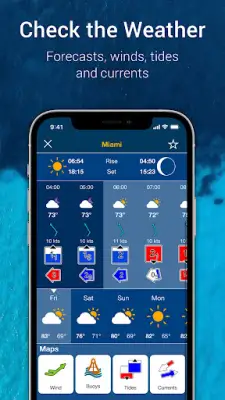
The application introduces several innovative tools aimed at enhancing trip planning and overall enjoyment for mariners. The Auto Guidance+ technology helps users efficiently plan their journeys by suggesting the best dock-to-dock routes based on navigational data. In addition, the application provides real-time weather updates, offering crucial forecast information, wind conditions, and tides, thus ensuring users are well-prepared before heading out on the water. Users can also mark key locations such as successful fishing spots, record their tracks, and capture photos and videos directly within the app, allowing for a reflective review of their adventures.
Community engagement is a significant aspect of the application, fostering an active network of boaters. The community edits feature enables users to share and acquire valuable local knowledge—covering points of interest and navigation aids—from thousands of fellow boating enthusiasts. Connections are easily maintained through live location sharing, track, route, and marker exchanges, facilitating meet-ups on the water and letting friends witness each other's excursions. Additionally, users can import and export GPX data, allowing for straightforward sharing of saved information and chartplotter transfers.
Designed to be compatible with external devices, the app enhances its functionality further. Users can sync their chartplotter with the app for seamless route and marker transfer, as well as for activating or updating their Navionics chartplotter card subscription. The SonarChart Live Mapping feature allows real-time map creation during navigation when connected with compatible sonar or plotter devices. Additionally, the app supports connectivity with compatible AIS receivers, enabling users to monitor nearby marine traffic and set alerts for potential collisions, thus promoting safer navigation practices.
Rate the App
User Reviews


Popular Apps