Latest Version
24.48.0
December 18, 2024
onXmaps
Maps & Navigation
Android
12
Free
onxmaps.offroad
Report a Problem
More About onX Offroad: Trail Maps & GPS
OnXmaps, Inc. provides a unique application designed to assist outdoor enthusiasts by offering access to various government information, although it does not act as a representative for any governmental or political organization. Users can access a variety of public information linked within the app, particularly through .gov links that facilitate further exploration of relevant government resources.
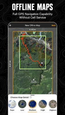
The app boasts a significant functionality that allows users to navigate even when they are outside of cell service. By saving offline maps, adventurers can carry their customized maps along for their journeys, effectively transforming their smartphones into handheld GPS devices. This feature enables users to follow their location denoted by a blue dot, ensuring they always know how to return home after their excursions.
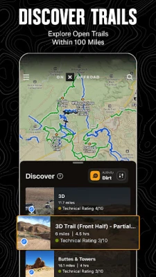
A comprehensive library of map data elevates the user experience, allowing individuals to view essential off-road trails, public land boundaries, and recreation points. The data is sourced from respected entities such as the USFS (U.S. Forest Service) and NPS (National Park Service). Users can interact with the map to locate hiking trailheads, fuel stations, and various recreational access points. The app also supports different visualization modes, including 3D, topographical, and satellite imagery, helping users better understand the landscapes they explore.
The onX app offers exclusive features for its Elite users, including access to detailed private property maps that outline land ownership and boundaries across the country. This enables users to ascertain where they can off-road safely, access camping areas, and identify landowners along certain trails. The Private Land Map Layer is particularly useful for those looking to enhance their off-road adventures by knowing where they are permitted to explore.
In addition to planning and navigation tools, the onX app allows users to record their trips, ensuring they can mark important points of interest and share their experiences with friends and family. Users benefit from features like tracking their route, speed, and distance. The app also integrates with Android Auto, offering hands-free navigation and in-dash access to the off-road maps, enhancing the overall usability of the application while on the move. For those seeking more detailed off-road information, onX offers premium features that include extensive maps and points of interest, equipping adventurers with an all-in-one tool for their outdoor journeys.
▶Government Information
onXmaps, Inc. does not represent any government or political entity, though you may find various links to public information within our services. For more information on any government information found within the services, click on the associated .gov link.
▶Navigate Without Cell Coverage
Save Offline Maps to bring your custom maps and adventure along when you're outside cell coverage on the trail. With the onX Offroad App, you turn your phone into a handheld GPS device using your phone's internal GPS. Navigate offline by following the blue dot to always know how to get home–wherever home is that night.
▶Adventure is Tap Away with Our Library of Map Data
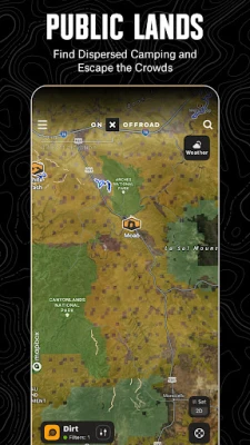
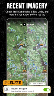
With map data sourced from USFS, MVUM, BLM, and NPS, our color-coded basemap includes off-road trails, Public Land boundaries, and recreation points to let you quickly scan for open routes near you and locate dispersed camping or campgrounds. Tap anywhere on the map to find hiking trailheads, trailer parking, non-ethanol fuel stations, boat launches, fishing access, and more. Scout the landscape and visualize mountains by viewing your maps in 3D, topo, satellite imagery, or a hybrid.
▶Private Property Maps With Boundaries-Elite Only
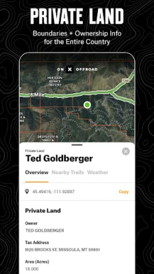
Make your maps Elite to discover more off-road access with private property boundaries and data for the whole country. Know where you can off-road and camp, and find out who owns OHV trails or the property next to a trail easement with our Private Land Map Layer.
▶Plan, Record, Save, and Share Your Trips
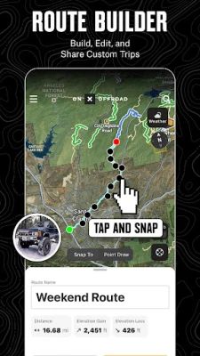
Drop Waypoints to save points of interest on your maps and share locations with others. Go and Track records and saves your speed, distance, location, and leaves a breadcrumb trail so you’ll always find your way back and can share your ride with friends and family.
▶Off-Road Trails In Your Vehicle’s Dash
Android Auto compatibility lets you enjoy hands-free navigation and view off road trails and maps in-dash. *When in service, Android users can see their in-dash maps in 3D.*
▶ PREMIUM AND ELITE OFFROAD APP FEATURES:
▶Private Land Layer-ELITE ONLY: Nationwide private property maps and land boundaries, ownership information, and acreage
▶985 million acres of Public Land across the U.S.
▶615,000+ miles of motorized roads and trails off-road for 4x4, Side-by-Side, dirtbikes, dual sport,, ATV, Quads, Overlanding, and snowmobiling
▶24K topographic maps and 3D maps for the entire U.S.
▶Designated camping areas, campsites, campgrounds
▶Hot Springs, Breweries, and much more
▶Save unlimited Offline Maps for offline navigation without cell service
▶Mark points along your route with photo Waypoints to plan and share your adventures.
▶onX OFFROAD GOVERNMENT DATA SOURCES:
https://data.fs.usda.gov/geodata/
https://gbp-blm-egis.hub.arcgis.com/
https://www.arcgis.com/home/group.html?id=00f2977287f74c79aad558708e3b6649#overview
▶ TERMS OF USE: https://www.onxmaps.com/tou
▶Privacy Policy: https://www.onxmaps.com/privacy-policy
▶ FEEDBACK:
At onX it’s our mission to help you find new places to explore with confidence, knowing you have onX Offroad with you.
If you have any trouble or have an idea on what you’d like to see in the app next, please contact us at support@onxmaps.com. We’d love to hear from you.
Rate the App
User Reviews
Popular Apps


