Latest Version
3.0
March 06, 2025
Yuber Apps
Maps & Navigation
Android
1
Free
com.buneme.fitness.findarun
Report a Problem
More About Plan Myrout: Run Route Planner
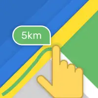
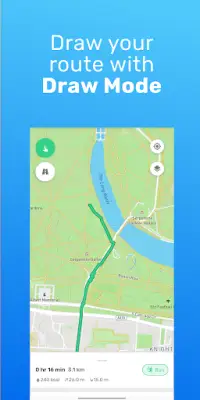
The application enables users to easily plan customized routes for various activities such as hiking or exploring new areas. With the main route planner screen, users can either enter a destination or draw a route directly on the map using touch gestures. Once a route is created, the app provides essential information like the total distance in kilometers or miles. Additionally, users can save their routes within their profile, making it convenient to revisit specific paths for activities such as running, which can enhance their training routines.
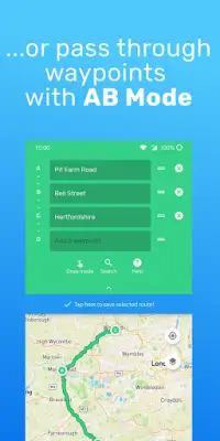
A standout feature of this application is its A-B mode, which is particularly favored by users. This feature allows individuals to select a starting point and a destination, along with any desired waypoints. The app then automatically calculates and suggests alternative routes, giving users the freedom to choose the option that best suits their preferences. This capability not only streamlines route planning but also ensures that users can efficiently navigate their desired paths across the map.
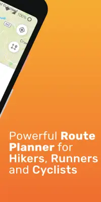
The app also addresses user requests for a variety of map styles. Users can select from multiple map types tailored to specific activities: a classic “normal” view, a “satellite” view for a bird’s eye perspective, a “cycling” map that is optimized for bike routes, and a “hiking” map that highlights trails ideal for walkers. This versatility allows users to select the most appropriate map style based on their planned activity, enhancing their overall experience while exploring.
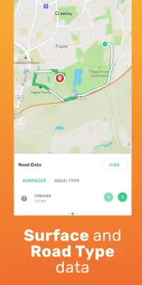
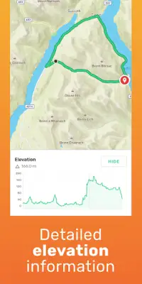
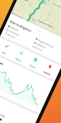
To further aid in route planning, the app provides additional information about each route, including road surface conditions, road types, elevation profiles, and estimates on activity durations. This transparency empowers users to better prepare for their adventures by understanding what type of terrain they will encounter. For those who prefer a streamlined experience in drawing routes, the "Snap to road" feature ensures that hand-drawn paths align closely with actual roads, making it easier to plan routes without losing accuracy. For users seeking even more functionality and convenience, an upgraded premium version offers advanced features like detailed map styles, calorie burn estimates, and unlimited route saving, along with device synchronization with Google accounts to ensure that routes are always accessible.
Rate the App
User Reviews


Popular Apps